Most travellers land in Labuan Bajo, take a boat to Komodo, and fly home. Flores itself, an island roughly 360 km long, they never see. This is what they miss.
The mental map
Flores runs west to east. Labuan Bajo sits at the western tip; Ende and Maumere at the east. Flying between towns is far quicker than going overland, but the road is what opens up everything below.
1. Wae Rebo
A village above the clouds, home to the UNESCO-recognised Mbaru Niang. Reaching it means a two-hour trek from Denge. Staying the night changes the experience entirely; arriving in the morning and walking back down loses the best of it.
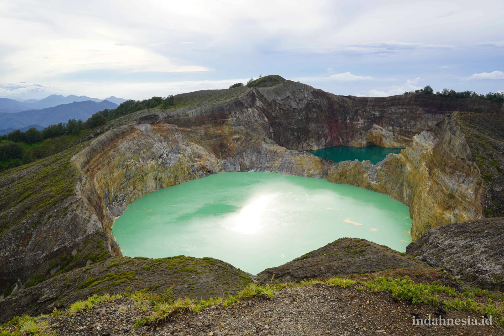
2. Lake Kelimutu
Three crater lakes whose colours shift over time. The right time is dawn, before the mist rises. A vehicle takes you most of the way, then stairs.
3. Bajawa
The villages of Bena and Luba, traditional houses on the slopes of Mount Inerie. Almost never on a standard itinerary, because it is not on the tour map.
4. Riung Seventeen Islands
A marine park most people have never heard of. The alternative to Komodo when you want quiet.
5. Ruteng
A cool highland town, the gateway to Wae Rebo, and spider-web rice paddies found nowhere else.
6. The southern coast
Beaches that appear in no brochure, heavy surf, difficult access. For people who have already been to Flores and want something else.
Stringing it together in 7–10 days
Two directions:
- West to east: Labuan Bajo → Ruteng → Bajawa → Riung → Ende → Kelimutu.
- East to west: the reverse.
West to east makes more sense on a first visit. The reverse suits a trip built around reaching Kelimutu at dawn.
What to prepare for
- Winding, narrow road on many stretches.
- Very few ATMs outside the main towns.
- Signal drops out on several sections.
- Fill the tank before long empty stretches.
See also how to get to Wae Rebo and the Flores destination page.